How LEXIS service improves local urban air-quality modelling
One of the use cases of the weather and climate pilot concerns the modelling of urban pollution at the local scale. Beyond the improvement on the weather, the WRF simulation part as described previously with the use of data assimilation (French Meteo France radar observation and Wundergound observation) and the use of IFS global forecast (ECMWF simulation) at the boundary, LEXIS service allows to also improve the air-quality simulation part.
In this use case, we employ the ADMS urban model (http://cerc.co.uk/environmental-software/ADMS-Urban-model.html) to simulate pollution over Paris. In such simulations, all sources are modelled as much as possible individually (stacks by point sources, roads by line sources, residential emissions are modelled by volume sources, etc). The atmospheric dispersion of each source is then calculated separately which can rapidly increase simulation time when we consider the large city. It regards the case even more when we consider the spatial resolution requires to reproduce the gradient of concentration near some sources due to the rapid decrease in the atmosphere with for example resolution of meter close to roads.
In consequence, urban modellers apply methods to reduce the number of explicit sources such as example filtering roads with low emission values which are then aggregated together into volume sources. The second point is that ADMS Urban is not parallelised, and one execution use only one core. The trick is then to divide the simulated domain into sub-domains which are executed separately on one each other’s core.
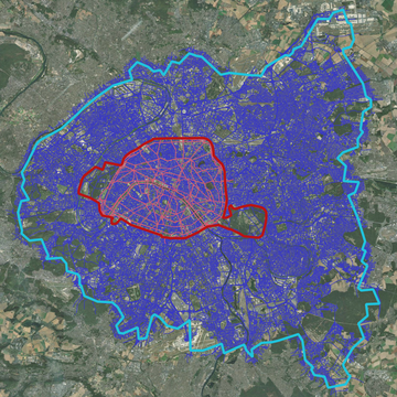
Considering the capacity of the LEXIS cloud server and the LEXIS management service, it was possible to avoid the filtering of emission sources as well as to increase the simulated domain. The result is a great extension of the modelling as shown on the next figure (blue compared to red) in terms of:
- Simulated area with a domain which covers now the full metropolitan region of Paris (772 km*km with 950 000 outputs points at surface) and not only the “inner centre” of Paris (106 km*km with 80 000 outputs points at surface).
- Simulated roads which are now 76 000 compared to 3 500 previously, and the other emission sources are 4 000 compared to 800.
The practical consequence is that the urban simulation requires now to manage 160 sub-runs in comparison with 13 sub-runs previously. Using 5 virtual machines of 32 cores in parallel conduct to an execution time of around 30 minutes which is acceptable.
For the demonstration phase, we identify a list of dates in 2018 for which the previous modelling leads either to over- or under-prediction of NO2 peaks (main pollutant at the local scale and not impacted by long-range transport of pollution) compared to the official AIRPARIF measurement network.
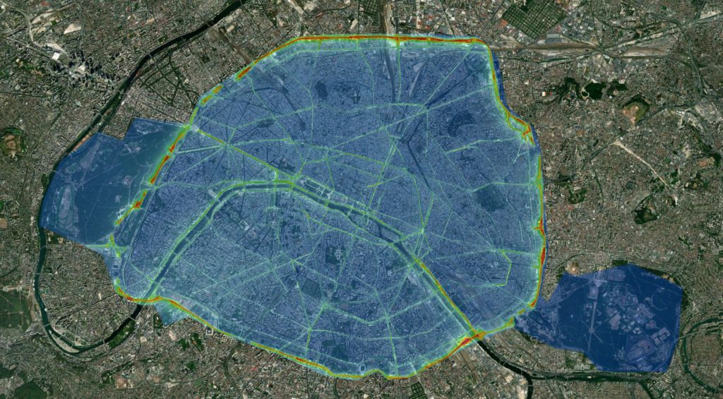
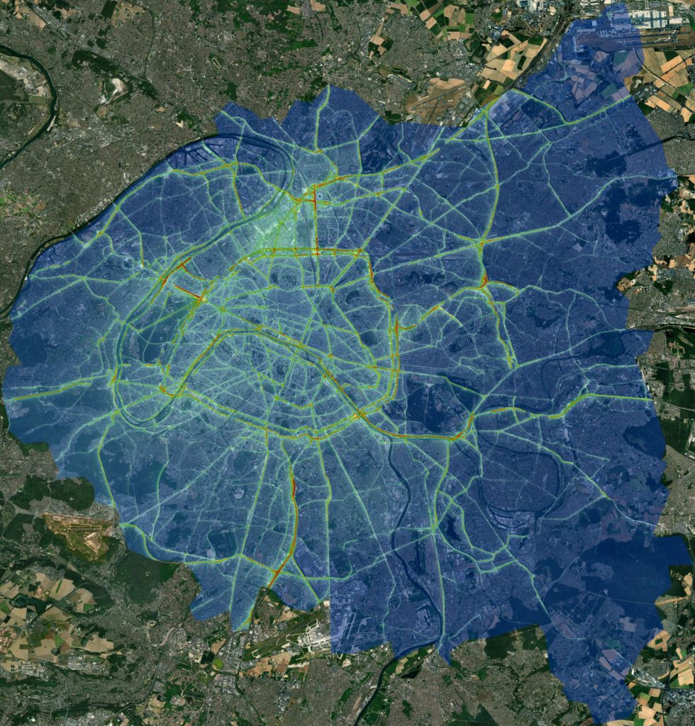
The next figure shows one example of NO2 surface pollution map obtained for 9 June 2018 at 12 HTU from the two modelling configurations (previous one and the LEXIS one). We clearly see the difference in terms of spatial resolution with much more visible impacts from roads, as well as more pollution spots.
Previous modelling
Modelling within the LEXIS project
In terms of performance, the expected KPI at the start of the project was to achieve 10% of improvement. Indeed, previous simulations were already good for the inner part of Paris based on multiple upgrades of the modelling. For the simulated dates and NO2 simulation, this KPI is nearly achieved. This result is encouraging, especially because the LEXIS simulation (WRF part for weather and ADMS urban for air quality) has been done from scratch without any adaptation after these first results. The interest of this new modelling is also to better capture the local pollution everywhere in the great Paris area and not only in the inner part of Paris.


")